DATA DETAILS > AERIAL PHOTOS
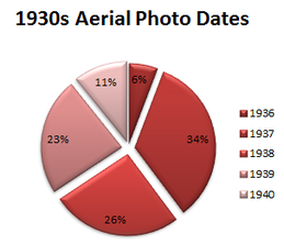
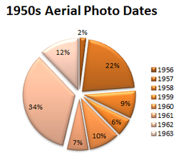
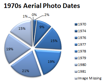
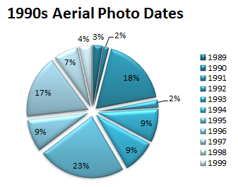
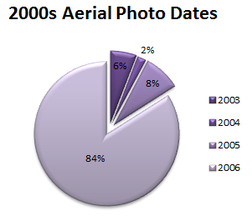
Aerial Photo DatesWithin each study year (e.g. 1930s), the dates of the individual photos vary. For example, photos from the 1930s were taken between 1936 and 1940 and photos from the 1950s were taken between 1956 and 1963. The graphs in this section show the percentage of images that were collected during each year for each study time period.
|
|
|
|
|
|