DATA DETAILS > BOUNDARIES
The feature classes below are stored in the project database within the "boundaries" feature dataset.
Recommended Uses: reference layers on maps; unit of analysis to generate spatial statistics from geoprocessing tools like intersect and dissolve.
Recommended Uses: reference layers on maps; unit of analysis to generate spatial statistics from geoprocessing tools like intersect and dissolve.
sample_boxes
|
Spatial Information: 14,400 records; each polygon and row = one sample box.
Format: file geodatabase polygon feature class Feature Dataset: boundaries Primary Key: SampleBox_ID Attributes:
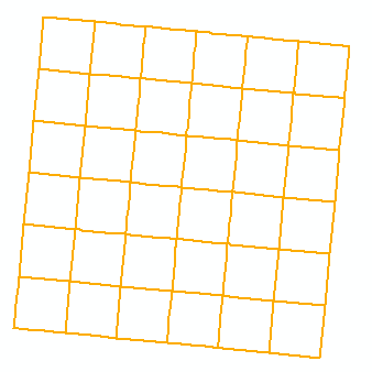
Scale: unknown. Source: Custom dataset created for the project for use as the main unit of analysis in spatial/statistical analyses. Each sample box is ~ 0.5 square miles by 0.5 square miles. Sub-division of sample boxes, with 36 sample boxes per sample grid. |
sample_grids
|
Spatial Information: 400 records; each polygon and row = one sample grid.
Format: file geodatabase polygon feature class Feature Dataset: boundaries Primary Key: SampleGrid_ID Attributes:
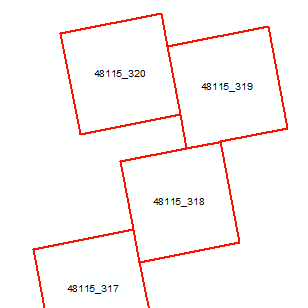
Scale: unknown. Source: Custom dataset created for the project used to delineate sample areas in which we created land use data. Each sample grid is ~ 3 square miles by 3 square miles. Boundaries are based on the Public Land Survey System. |
counties
|
Spatial Information: 50 records; each polygon and row = one county.
Format: file geodatabase polygon feature class Feature Dataset: boundaries Primary Key: OBJECTID Attributes:
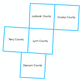
Scale: unknown. Source: Source unclear. Only the 50 counties within the study area are included in the file. |
states
|
Spatial Information: 10 records; each polygon and row = one state.
Format: file geodatabase polygon feature class Feature Dataset: boundaries Primary Key: OBJECTID Attributes:
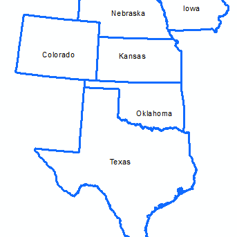
Scale: unknown. Source: Source unclear. Only the 10 states within the study area are included in the file. |
utm_zones
|
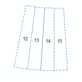
Spatial Information: 4 records; each polygon and row = one UTM Zone.
Format: file geodatabase polygon feature class Feature Dataset: boundaries Primary Key: OBJECTID Attributes:
Scale: unknown. Source: Source unclear. Only the 10 states within the study area are included in the file. |