Land Use Change in the U.S. Great Plains
  • Home
  • Team
  • Results
  • Data Overview
  • Data Details
    • Aerial Photos
    • Boundaries
    • Land Use
    • Natural Features
  • QAQC
  • Contact Us

TEAM

The project was lead by a team of researchers from the University of Michigan.  The spatial analysis tasks link together with a much larger project that began in 1995.  See the main project website for more information and the names of additional project investigators.

University of Michigan, Ann Arbor, MI

Spatial Data Team

Management Team:
  • Dan Brown, Project Investigator
  • Ken Sylvester, Project Investigator
  • Rachel Kornak, GIS Manager

18 Student Research Assistants: 
  • Becky Gajewski, Chuang-Chung Hu, and Greg Jacobs were instrumental in the data creation process.  
  • See full list of students and contributions below:

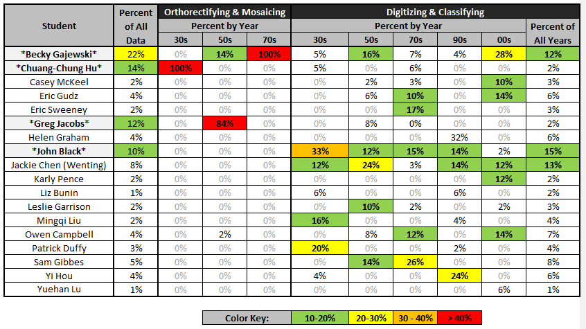
Percent of Project Completed by Each Research Assistant

Picture
Website and graphics created by Rachel Kornak, GISP.  Last updated Jan 20, 2014.