WELCOME
Population and Environment in the U.S. Great Plains analyzes the recursive relationships between environment, population, and land use in the Great Plains, a semi-arid grassland covering roughly one-third of the United States, over a period of about one hundred and fifty years. The project team includes historians, sociologists, anthropologists, and demographers at the University of Michigan, Colorado State University, and the University of Saskatchewan, with consultants at other universities. The project was funded by the National Institute of Child Health and Human Development. Learn more on the main project website at http://www.icpsr.umich.edu/icpsrweb/PLAINS/.
Research Objectives
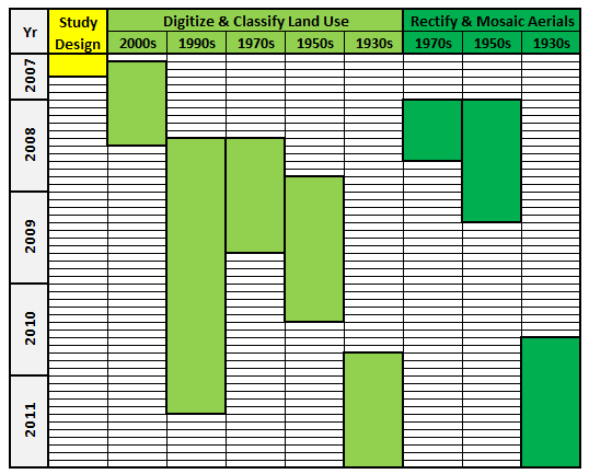
Data Creation ProcessDigitized and Classified over 0.4 million land use polygons:
|
Study AreaThe study area includes representative sample locations within the Great Plains Region of the United States. It covers 10 states, 50 counties, 400 sample grids (~9 mile * 9 mile), and 14,400 sample boxes. The video below shows how the sample areas are nested.
|
|
The land use data and aerial photo mosaics were created between 2007 and 2011 by a team of almost twenty research assistants.
|