DATA DETAILS
|
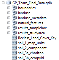
The final project data (vector) is housed in a file geodatabase (version 10.1).
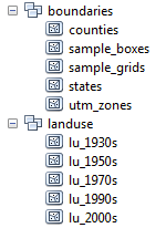
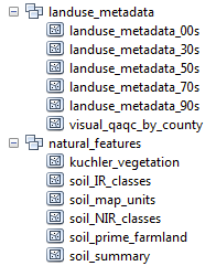
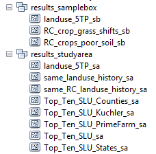
There are 33 individual feature classes and 5 tables in the database. The feature classes are organized by topic into 6 feature datasets, which are similar to file folders within the database. The screenshots below show the individual feature datasets within each "folder." Additional information about each feature dataset and table is available on the nested web pages under the main "Data Details" navigation tab. |
|
|
|